Hi everyone!
Hope you all have had a wonderful week!
Every once in awhile, I get scientist-y (is that a word?) here on Weather Wanderings. Especially when big weather events are happening. It also doesn’t hurt to talk about these things when I am doing discussion in class.
So let’s get right down to it. Starting with the most pressing matter: another Hurricane.
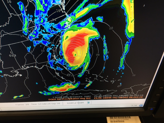
Hello, Matthew!
As you can see from the photo above, there’s a new Hurricane in town and this one’s name is Matthew. This storm was upgraded to a hurricane as of 2 p.m. Mountain Daylight Time.
At this moment, models predict the hurricane will move northward, pass Florida and possibly continue into the Atlantic Ocean, away from the US. Be forewarned, there’s still a lot that could go on in the next couple of days that would affect the storm’s path.
For more information about the Hurricane, click here
Now onto other severe storms:
Severe Storm Activity in Virginia:
One of the scary things about weather, it can go crazy at night!
Take a look at the discussion below. A thunderstorm with some rotation popped up around 7pm Eastern near Charlottesville, VA on 9/28/16. (Note: no tornado confirmed). However, I did look and some warnings were issued for this storm.
So, want to see what goes in to evaluating if a storm is severe? Here’s the very short discussion I wrote for my radar and satellite class. Enjoy!
1) Using Base Reflectivity 0.5 degrees (Figure 1), the first intense radar echo was observed at 2357 UTC on 9/28/16. The echo was located south of the Charlottesville, VA METAR. This is Northwest of the KAKQ Radar Station.
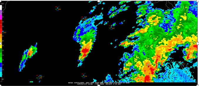
(Figure 1)
2)The wind according to the Base Velocity 0.5 degree product as shown in Figure 2 indicated a southwesterly flow. The Charlottesville METAR verified this observation.
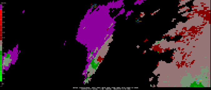
(Figure 2)
3) The EET product in Figure 3 indicated an echo top of 40,000 ft during the most intense precipitation period which is indicative of possible hail.
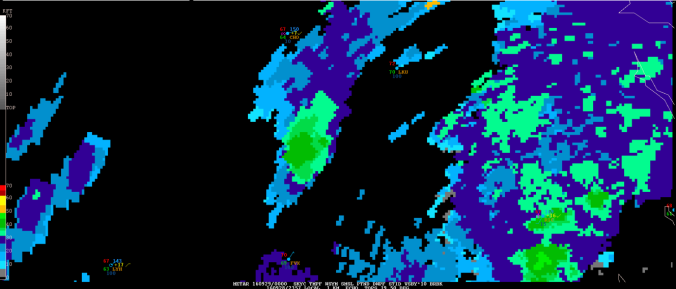
(Figure 3)
4)Using the NOH product to locate other hydrometers (Figure 4), the product shows that hail and graupel were present in the echo.

(Figure 4)
5) From the Storm Relative Velocity product in Figure 5, there was a storm with rotation located south of the Charlottesville METAR at 2357 UTC.
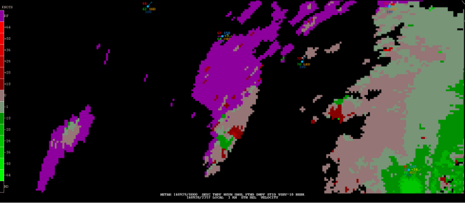
(Figure 5)